There’s a flood of commercial satellite imagery on the market. But how do you access all that information?
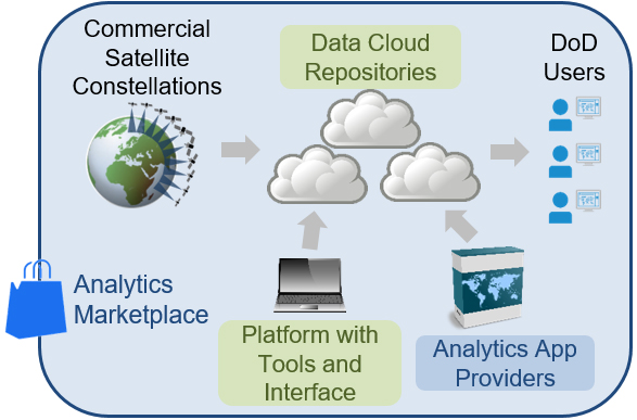
DARPA wants to tackle this by creating a repository that will collate satellite imagery from a variety of sources into a central library.
“The current ad hoc, time-intensive approach requires gathering and curating data from a large number of available sources, downloading it to specific locations, and running it through separate suites of analytics tools,” DARPA pointed out in a news release.
DARPA’s new Geospatial Cloud Analytics, or GCA, program will aggregate commercial and open-source satellite data — available as optical, synthetic aperture radar and radio frequency information — into a repository with with automated curation tools.
“In addition to developing a scalable geospatial data platform with tools and a user interface, GCA aims to create analytical applications that would allow analysts at the operational and tactical level to draw specific information from the aggregated data,” DARPA said. “GCA will pilot an analytical services business model where commercial entities offer analytics services and apps via a competitive marketplace.”
To test GCA, DARPA will use the repository to collect data on several global issues of varying time scales, including predicting food shortages in a region (weeks to months), locating the construction of oil fracking sites (days to weeks) and illegal fishing detection (minutes to days).